
DEVB TC(W) No. 1/2026
Co-supervision Platform projects in Hong Kong
Kodifly has fitted approximately 20 Hong Kong public works contracts with LiDAR, cameras and edge units for SmartEye, the Co-supervision Platform that DEVB TC(W) No. 1/2026 requires on capital works above HK$400 million. Each deployment is surveyed, mounted on poles or tower cranes, connected and commissioned by Kodifly as one project.
Where the platform is already running
The Co-supervision Platform (CSP) did not start with the mandate. DEVB launched SmartEye for pilot implementation in selected public works projects from late 2024 (Annex A, paragraph 1). The pilots covered site formation, deep excavation, building works including MiC, sewage treatment facilities, water infrastructure, and landslip prevention and mitigation works (paragraph 9). The Works Policies Coordination Committee then supported mandating it in March 2025.
Kodifly has fitted approximately 20 Hong Kong public works contracts with LiDAR, cameras and edge units. The list below shows the works department and the scope Kodifly supplied for each contract. Site names are withheld, and no contract values are shown.
- 20
- Hong Kong public works contracts fitted with Kodifly LiDAR, cameras and edge units, approximately.
- 2
- capture approaches, fixed-point and fixed-route.
- ±2 cm
- range accuracy from ScanStation.
- 100+
- sites with Kodifly systems implemented.
Public works contracts by department
Works department and the scope Kodifly supplied. Site names are withheld.
| Department | Scope |
|---|---|
| ArchSD | SmartEye site hardware and software |
| ArchSD | Site dashboard |
| CEDD | Slope gradient monitoring software |
| CEDD | SmartEye site hardware and software |
| CEDD | Volume monitoring software |
| CEDD | Drone survey |
| DSD | SmartEye site hardware and software |
| DSD | Site dashboard |
| DSD | SmartEye site hardware |
| DSD | Environmental monitoring and excavation-volume software |
| EMSD | Fixed-point LiDAR |
| GEO | Flexible barrier monitoring |
How a deployment runs
The same sequence on every contract, from first visit to a running record on the platform.
Survey the site
We look at the works type, the CSP functions in scope and the site layout, then advise where fixed-point units and drone routes should cover.
Mount the fixed units
ScanStation K4DL-1000 goes on poles, tower cranes or other fixed structures with a clear view of the works. Its IP65 housing suits site conditions.
Set the drone route
Drones on a fixed route cover what a fixed unit cannot see, on the same coordinate frame as the fixed units.
Connect the edge units
Edge units sit with the LiDAR and cameras at each capture point, and each point is connected so its data reaches the platform.
Commission and hand over the record
Real-time colourised point clouds with centimetre-level georeferencing start flowing, and the site reports and DWSS link go live.
What changes as the site changes
A site does not keep the same shape for long. Structures rise and hide areas that a pole could see on day one. Tower cranes are erected and dismantled. The capture plan has to follow that, so fixed units are placed with the build sequence in mind and drone routes are adjusted to cover new blind spots.
Because ScanStation stays put and watches the same ground, every scan is comparable with the last. That continuity is what the time series point cloud viewer and the measurement functions in Annex A, paragraph 5, rely on. The drone passes add coverage without breaking the record.
The CSP also connects with the Smart Construction Management hub of the DWSS (paragraph 8). Kodifly's SpatialSense is a DWSS, so site reports and the DWSS link come from the same project team as the capture.
Capture equipment in the field
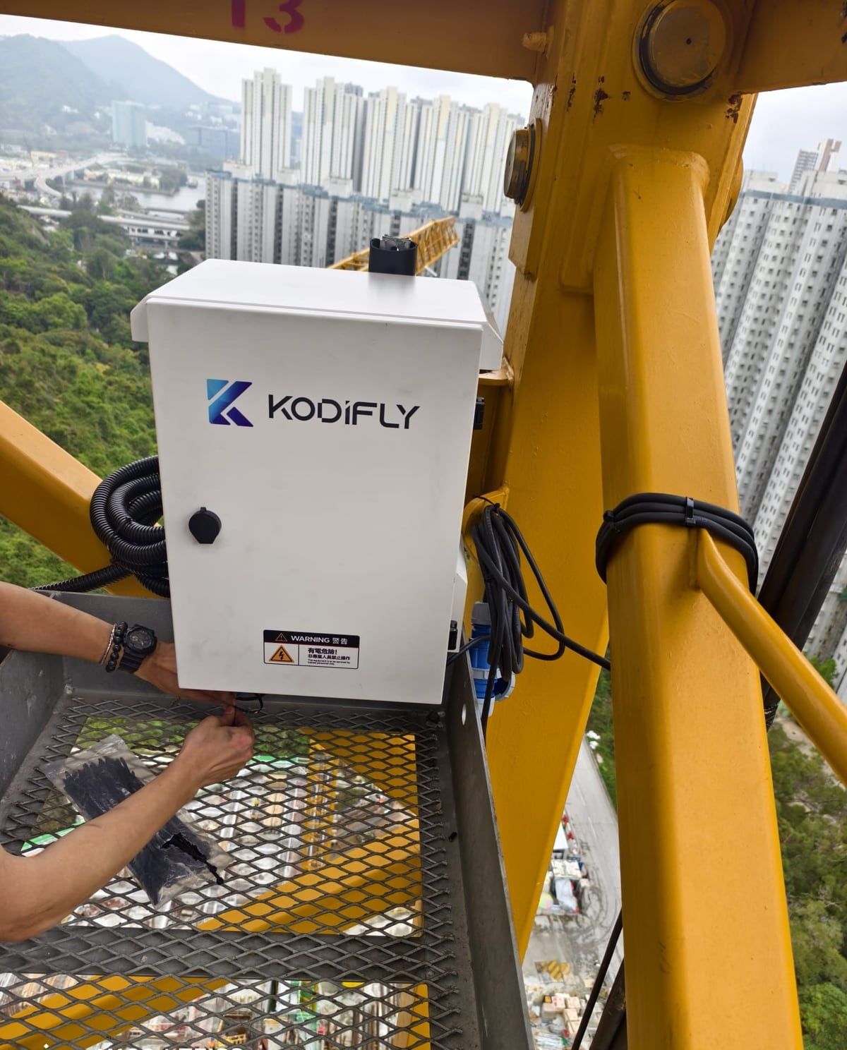
Site unit being installed on a tower crane. 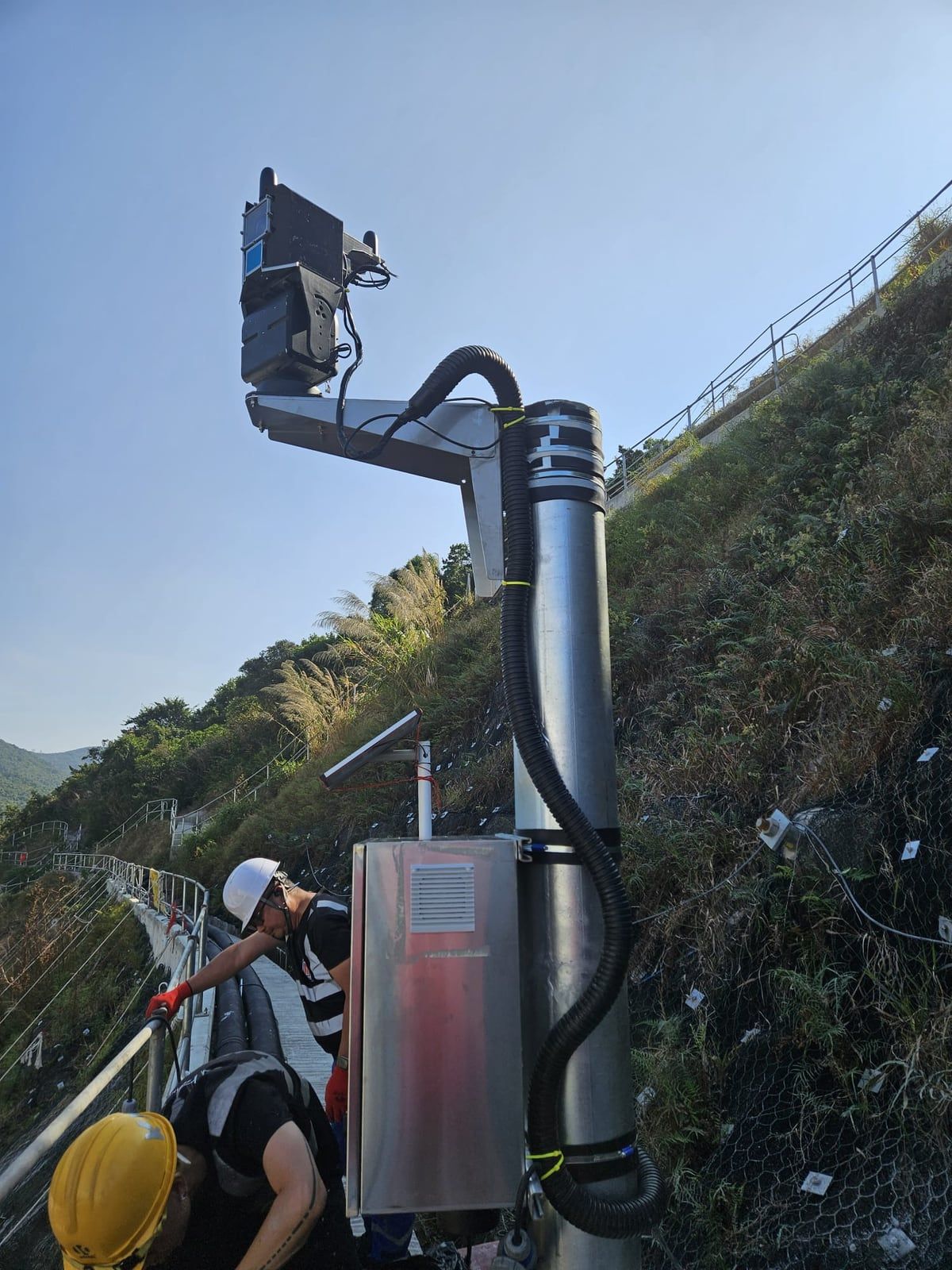
LiDAR unit and equipment cabinet on a pole at a public works site. 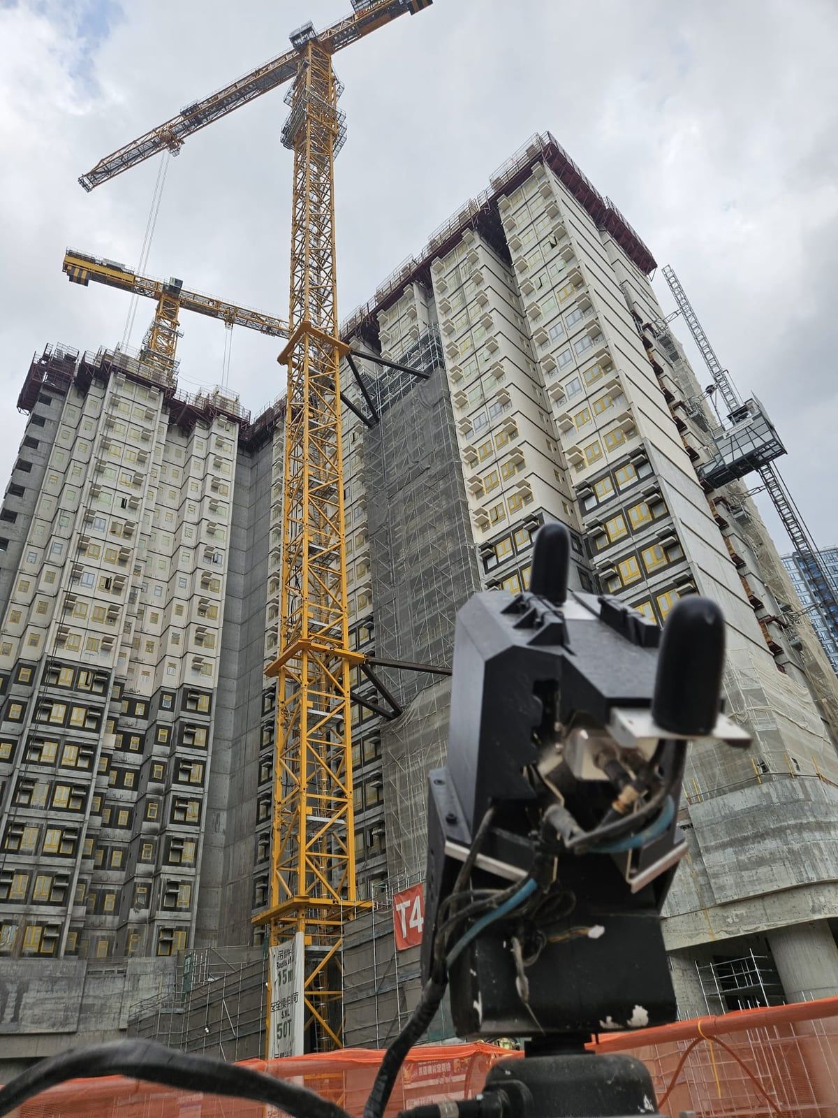
Fixed-point LiDAR facing residential blocks under construction. 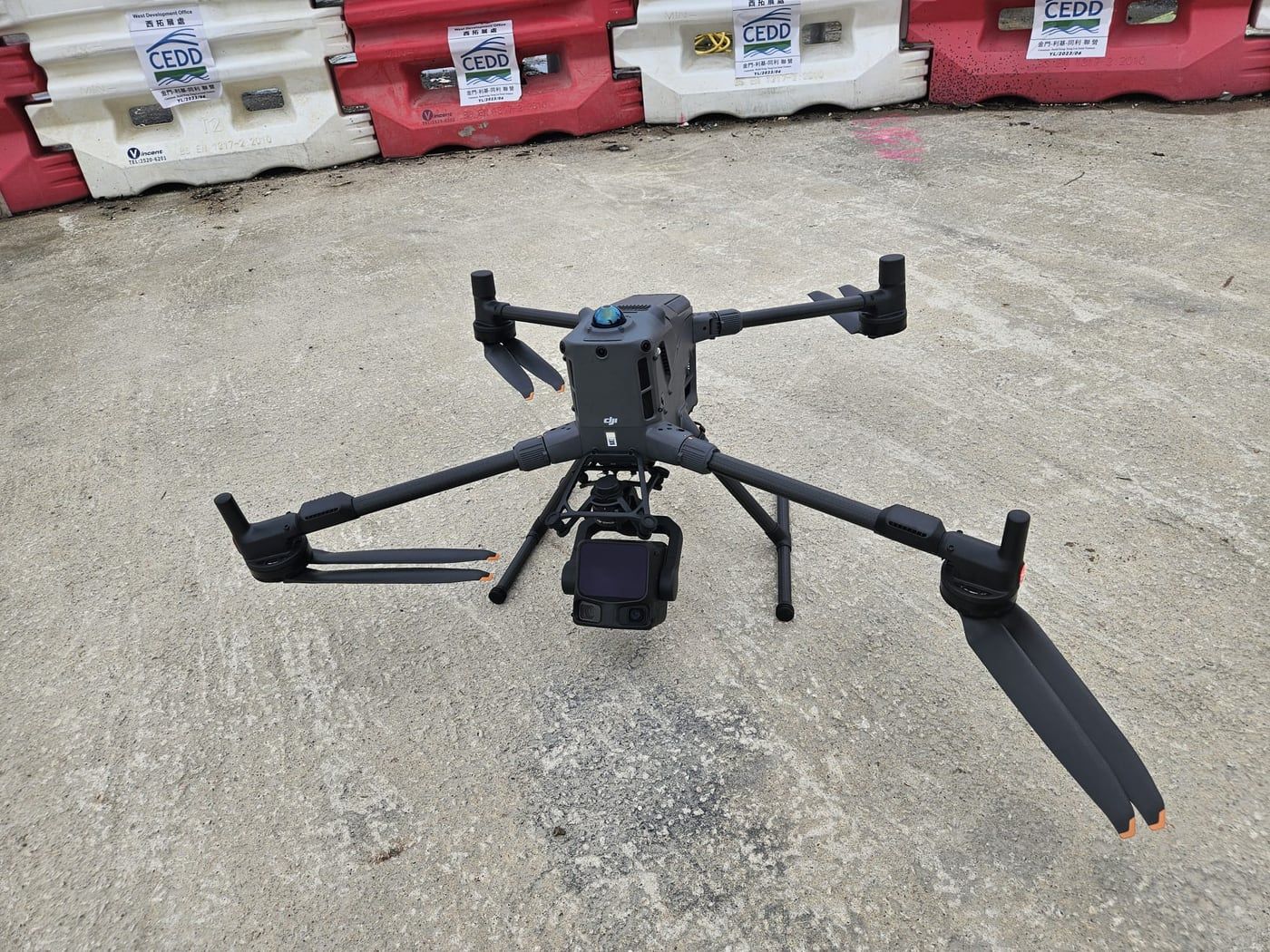
Survey drone at a public works site.
Deployment questions
How many Co-supervision Platform sites has Kodifly equipped?
Kodifly has fitted approximately 20 Hong Kong public works contracts with LiDAR, cameras and edge units. The project list on this page shows the works department and the scope Kodifly supplied for each.
Why are site names not shown?
The list is anonymised. It shows the works department and the scope Kodifly supplied for each contract, and never contract values.
Since when has SmartEye been in use?
DEVB says SmartEye has been launched for pilot implementation in selected public works projects since late 2024 (TC(W) No. 1/2026, Annex A, paragraph 1). The mandate applies to capital works above HK$400 million tendered on or after 1 April 2026 (paragraph 10).
Which works types have used the platform?
Paragraph 9 of TC(W) No. 1/2026 lists pilots in site formation, deep excavation, building works including MiC, sewage treatment facilities, water infrastructure, and landslip prevention and mitigation works.
Where is the LiDAR mounted?
Fixed-point units go on fixed poles, tower cranes or other non-movable objects, as Annex A, paragraph 2(i), describes. Fixed-route capture uses drones flown on a set route to cover blind spots.
Who installs and supports the equipment?
Kodifly delivers the capture as one project, survey, mounting, connection, commissioning and support, together with the site reports and the DWSS link.
Related guides
Fixed-point vs fixed-route LiDAR
Poles and tower cranes against drones and robots, and when to use each.
Plan the deployment for your site
Tell us the site, works type and tender date. We will plan fixed-point and fixed-route capture.