
DEVB TC(W) No. 9/2025
Drone progress monitoring on SpatialSense
DEVB TC(W) No. 9/2025 requires qualifying Hong Kong capital works contracts to adopt drone progress monitoring, with 3D photogrammetry models submitted every two weeks. Kodifly flies the capture, and SpatialSense compares the models over time and passes them into the DWSS.
The HECR-4 baseline, and where Kodifly fits
The Inventory lists seven baseline technical requirements for a progress-monitoring drone. Kodifly's drone service covers the aircraft and capture side, and SpatialSense covers the comparison and the DWSS link.
| Baseline requirement | What the Inventory asks | Where it is met |
|---|---|---|
| 1. Regulation | Comply with Cap. 448G. | Drone service |
| 2. Imagery | Aerial photography at 48MP, 720 panorama images, fly-through videos at 4K, and real-time live streaming. | Drone service |
| 3. 3D models | 3D photogrammetry models at 2 cm resolution, georeferenced, in OBJ format, with image overlap above 80%. | Drone service |
| 4. Positioning and limits | Geofencing, altitude and distance limits, and a real-time kinematic (RTK) positioning system with accuracy better than 5 cm. | Drone service |
| 5. Progress over time | Let users visually track and compare the progress of a project over time by 3D photogrammetry model, in date order. | Live |
| 6. Obstacle avoidance | An omnidirectional obstacle avoidance system. | Drone service |
| 7. Management system | Internet accessible and BIM compatible, with automatic transfer of the 3D photogrammetry model to the Digital Works Supervision System. | Live |
Ask us for the aircraft specification and permits for your site.
Compare
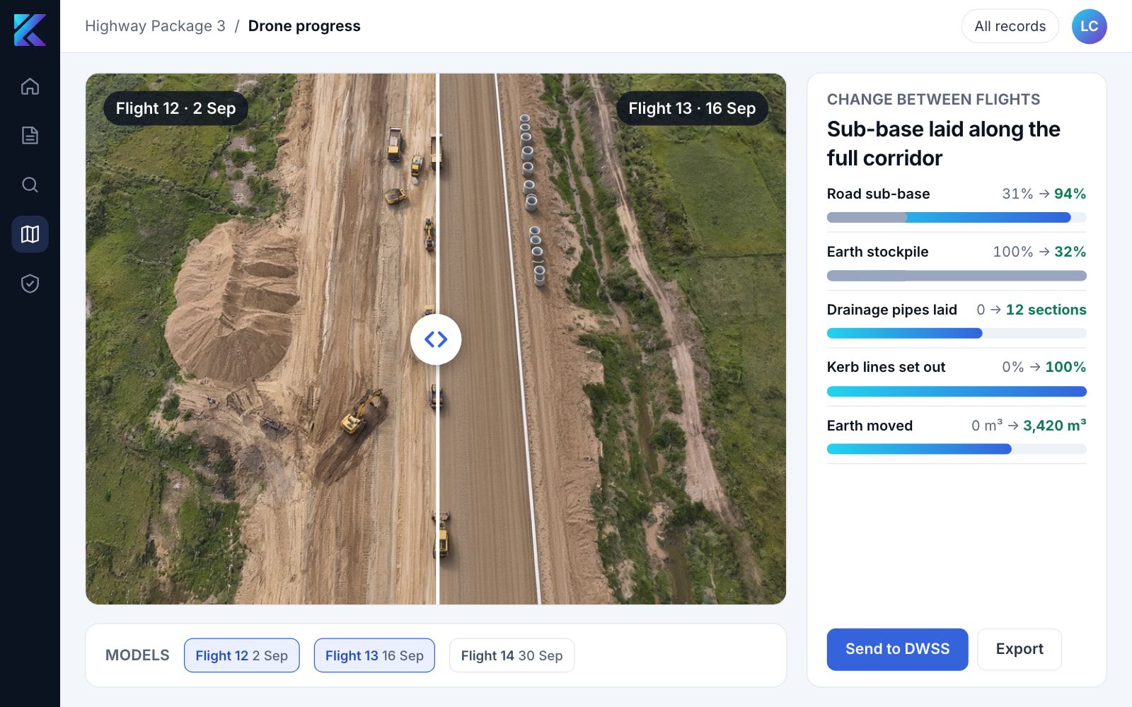
See progress between flights.
Open any two dates side by side. What was built, moved or missed is visible on screen without another site walk, and the biweekly model lands in the DWSS.
Why Kodifly for drone progress monitoring
Capture, comparison and the DWSS link from one team.
Flown and compared by one team
Kodifly flies the capture and SpatialSense compares the models over time, so the biweekly submission does not pass between suppliers.
Straight into the DWSS
The Inventory asks for automatic transfer of the 3D photogrammetry model to the DWSS. SpatialSense is the DWSS, so the model lands in the same record as your site diary.
Date against date
Open any two flights side by side and see what was built, moved or missed without another site walk.
The requirement at a glance
- Circular
- DEVB TC(W) No. 9/2025, Adoption of Construction Robots. The Inventory is updated by DEVB, and this page follows the issue of 24 August 2026.
- Applies to
- Capital works contracts above HK$30 million tendered on or after 1 April 2026 (paragraph 8).
- Drone item
- HECR-4. All contracts except works that drones cannot view.
- Frequency
- Biweekly submission of 3D photogrammetry models of the construction site.
- Records and exemption
- Project offices measure productivity and keep records (paragraph 13), and the managing department may exempt a contract on exceptional grounds (paragraph 15).
The Inventory also lists a remote-control tower crane system, a drilling robot and a welding robot. These are separate machines, and Kodifly does not supply them.
Drone progress monitoring questions
What is HECR-4?
HECR-4 is the drone item in DEVB's Inventory of Highly-Effective Construction Robots under TC(W) No. 9/2025. It covers drones used for progress monitoring, with biweekly submission of 3D photogrammetry models, against seven baseline technical requirements.
Who must adopt drone progress monitoring?
Qualifying contracts adopt the robots in DEVB's Inventory. The drone item, HECR-4, applies to all contracts except works that drones cannot view, with biweekly submission of 3D photogrammetry models.
How does the 3D model reach the DWSS?
The Inventory asks for automatic data transfer of the 3D photogrammetry model to the Digital Works Supervision System. SpatialSense is the DWSS, so the model lands in the same system as your site records.
Is this the same as fixed-route drone LiDAR for the Co-supervision Platform?
They are related but separate. Drone progress monitoring answers TC(W) No. 9/2025. Fixed-route drone LiDAR is one of the two ways to produce the point-cloud video for the Co-supervision Platform under TC(W) No. 1/2026.
Does Kodifly supply the other construction robots?
No. Kodifly covers the drone progress-monitoring item only.
Plan your drone capture
Tell us the site, the works type and the tender date. We will advise how the biweekly flights and the DWSS link fit your contract.