
DEVB TC(W) No. 1/2026
4D LiDAR capture for the Co-supervision Platform
The Co-supervision Platform is DEVB's remote supervision system for Hong Kong capital works above HK$400 million tendered from 1 April 2026. It runs on 4D LiDAR data. ScanStation and drone LiDAR provide that capture, fixed-point and fixed-route.
From the pole to the project team.
Fixed-point and drone LiDAR build a 4D model, and the AI flags what changed between scans.
On site
Capture
- Fixed-point LiDAR
- Drone LiDAR
4D model over time
SpatialSense AI
- Builds the 4D model
- Compares each scan
- Flags what changed
Connected to the DWSS
Remote supervision
- Data to the DWSS hub
- Records for the project team
Two ways to capture a site
The circular says the 4D LiDAR "Video of Point Cloud" can be produced with a fixed-point approach or a fixed-route approach. Kodifly provides both.
Fixed-point
ScanStation K4DL-1000
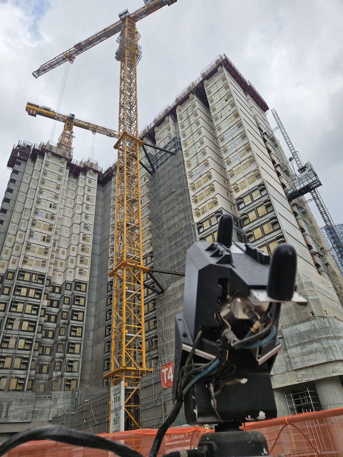
LiDAR mounted on fixed poles, tower cranes or other non-movable objects, observing a defined area over time. ScanStation is built for this role, with ±2 cm range accuracy and centimetre-level georeferencing.
Fixed-route
Drone LiDAR on a set route
Small unmanned aircraft flown on a fixed route to minimise blind spots and provide continuous spatial data across areas a fixed unit cannot see.
Why Kodifly for the capture
What we supply to a Co-supervision Platform contract, and where the platform takes over.
Both capture approaches
Fixed-point ScanStation and fixed-route drone LiDAR from one supplier, planned together so that one covers the other's blind spots.
Used on public works
About 20 Hong Kong public works contracts are fitted with Kodifly LiDAR, cameras and edge units.
Reports drafted for you
SpatialSense drafts the site reports from the same record, for your team to review before they go out.
A clear boundary
The analytics and the AI chatbot sit in DEVB's platform. Kodifly supplies the capture and the reports, and says so up front.
What the platform does, and where Kodifly fits
Annex A of the circular lists nine functions. Kodifly supplies the 4D LiDAR capture they run on, and SpatialSense drafts the site reports. The analytics and the AI chatbot sit in the platform.
| Function | Purpose | Kodifly's part |
|---|---|---|
| Time series point cloud viewer | View 4D LiDAR videos of the site over time. | Capture input |
| Dimension and volume measurement | Measure built structures and quantities remotely. | Capture input |
| Slope angle and ground profile measurement | Check slopes and ground profiles from the point cloud. | Capture input |
| Reinforcement bar fixing check | Support checks on rebar fixing. | Capture input |
| MiC installation productivity check | Check productivity of Modular Integrated Construction installation. | Capture input |
| Tower crane efficiency check | Check the efficiency of tower crane operation. | Capture input |
| Alerts system | Instant alerts on site issues. | Capture input |
| Site report generation | Automated site reports. | Live |
| AI chatbot | Ask questions of site data in natural language. | In the platform |
From DEVB TC(W) No. 1/2026, Annex A, paragraph 5. New functions, such as NEC contract administration modules, are being introduced in stages by DEVB.
The requirement at a glance
- Circular
- DEVB TC(W) No. 1/2026, issued 8 January 2026, to be read with TC(W) No. 8/2025.
- Must adopt
- Capital works contracts with a pre-tender estimate above HK$400 million and tendered on or after 1 April 2026 (paragraph 10).
- Encouraged
- Other new or ongoing capital works contracts, as far as practicable. Maintenance and term contracts may adopt it where applicable (paragraphs 10 and 11).
- Scope vetting
- Project offices submit the proposed Co-supervision Platform scope and draft tender provisions to DEVB's Works Policies 4 Section for vetting, until March 2028 or a date DEVB announces (paragraph 15).
- Exemption
- On exceptional grounds such as a short construction period, changing site locations or minimal works content, with policy consent from Works Policies 4 Section (paragraph 17).
- Link to DWSS
- The platform connects with the Smart Construction Management hub of the DWSS by API or other means. DWSS acceptance, handover, technical audit and iCWP requirements apply to it (paragraph 16).
Capture equipment in the field
Fixed-point LiDAR and survey drones on public works sites.
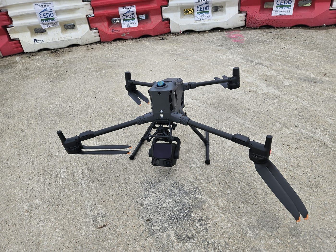
Survey drone at a public works site. 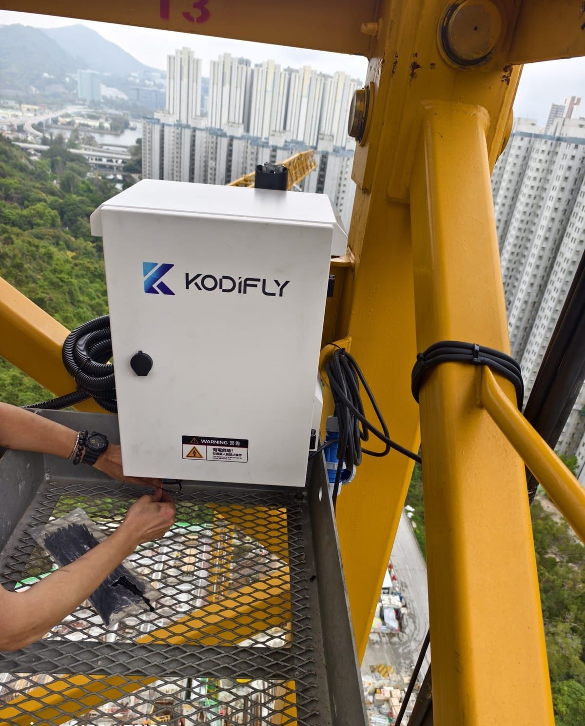
Site unit being installed on a tower crane. 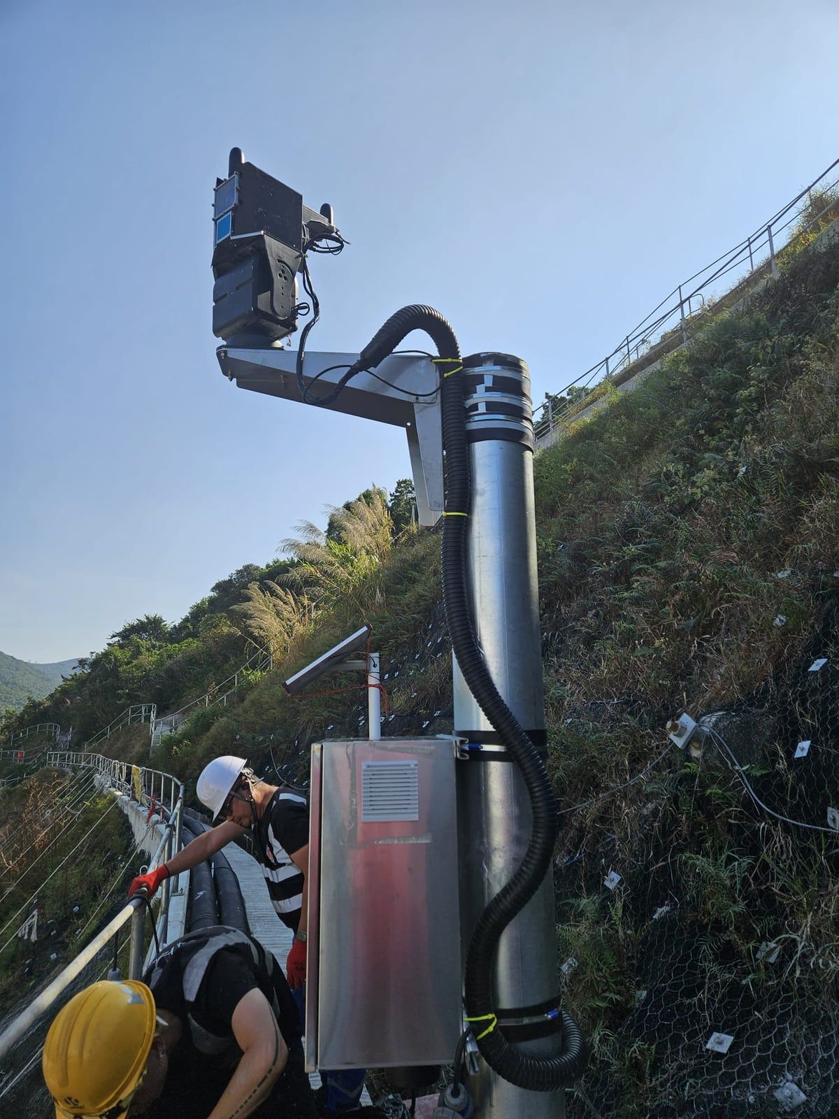
LiDAR unit and equipment cabinet on a pole at a public works site. Fixed-point LiDAR facing residential blocks under construction.
Co-supervision Platform questions
What is the Co-supervision Platform?
It is DEVB's remote supervision platform for smart construction management under TC(W) No. 1/2026. Its Video of Point Cloud uses 4D LiDAR to capture the spatial data of a site over time, so works departments, consultants and contractors can check workmanship, productivity, positions and dimensions off site (paragraph 7).
Is the Co-supervision Platform the same as SmartEye?
In DEVB's circular, SmartEye is the in-house solution that establishes the Co-supervision Platform. Other vendors sell products with similar names, so check that you are dealing with DEVB's platform.
Who decides the scope for my project?
The project office defines the scope of functions suited to the works, using DEVB's sample specification and consulting Works Policies 4 Section. The proposed scope and draft tender provisions go to that section for vetting (paragraphs 14 and 15).
What sensors does the platform use besides LiDAR?
It can retrieve and analyse data from AI cameras, body-worn cameras, IoT sensors for temperature, humidity and vibration, and other devices such as thermal sensors, fibre optic sensors and handheld laser scanners (Annex A, paragraph 3).
Can a short or small contract be exempted?
Yes, on exceptional grounds with policy consent from DEVB's Works Policies 4 Section (paragraph 17).
Plan the capture for your site
Tell us the site, the works type and the tender date. We will advise how fixed-point and fixed-route capture cover it.